Disaster & Emergency Services
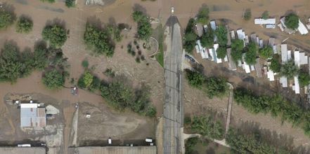
With 10 years of law enforcement experience and 16 year's experience in the fire emergency services, VAS can provide seamless support in emergency situations. Natural disasters such as hurricanes, earthquakes, flooding, mudslides and forest fires can dramatically change the landscape or infrastructure of an area. These disasters can lead to logistical issues and can hinder support efforts. It’s crucial that first responders have aerial footage and updated maps so support efforts will not be hindered.
VAS can fly over an affected area and create a 2D or 3D map of an incident in order to aid in search and rescue, disaster assessment, and recovery planning. VAS can also provide contractual services to local government agencies for live aerial video feed for a variety of emergency scenes. Live video feed can be transmitted to the VAS onsite mobile command center. This command center will provide a heated shelter, electricity, office space and supplies, and a large live screen display of the aerial footage of a scene.
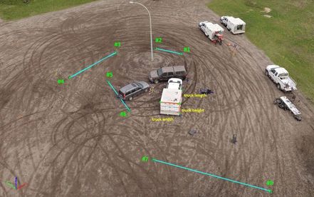
The live aerial view can give firefighters insight of fire containment or provide law enforcement with solutions to accessing unsafe scenes. VAS can also use aerial data to create 3D reconstructions of incident scenes. These incidents are to include, but are not limited to, barricaded gun men, bank robberies, and traffic crash reconstructions. VAS can comply with evidence chain of command and FBICJIS Policy requirements.


