Forestry & Agriculture Monitoring
The challenge for foresters and forest management consultants is to maintain the health of the forests of our planet and at the same time, facilitate commercial exploitation of its resources in a socially acceptable manner. There are several tasks where a drone may help forestry managers:
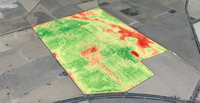
UAS’s can provide farmers and insurance companies with time and money saving aerial solutions. VAS can conduct flights over the target crops on any desired schedule. UAS software then analyzes the collected data to provide farmers with money saving solutions to their crop management.
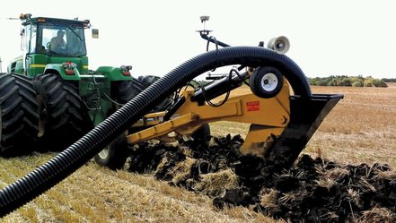
A UAS can also collect data to produce topographic maps and point clouds over agriculture land that needs additional drainage. The data can then be uploaded into software and which show farmers the most efficient locations to add drain tiles or ditches.
- Improve forest management and operational planning
- Inventory Assessment for valuation and taxation
- Monitoring of illegal activities and encroachment such as logging
- Research into health of forest enabling targeted response
- Rapid response to environmental impact events – e.g. assess storm damage
UAS’s can provide farmers and insurance companies with time and money saving aerial solutions. VAS can conduct flights over the target crops on any desired schedule. UAS software then analyzes the collected data to provide farmers with money saving solutions to their crop management.
A UAS can also collect data to produce topographic maps and point clouds over agriculture land that needs additional drainage. The data can then be uploaded into software and which show farmers the most efficient locations to add drain tiles or ditches.