Vandermissen Aeronautical Solutions
  • Home
  • About
  • Services
    • Aerial Video & Photography
    • Motion Picture & News Filming
    • Real Estate Photography
    • Forestry & Agriculture Monitoring
    • Bridge & Tower Inspections
    • Disaster & Emergency Services
    • Mining Services
    • Project Monitoring
    • Geographic Information Systems Photography
    • Photogrammetry Designs & Topographic Mapping
  • Photos
  • Contact

Photogrammetry Designs & Topographic Mapping

Photogrammetry Designs & Topographic Mapping

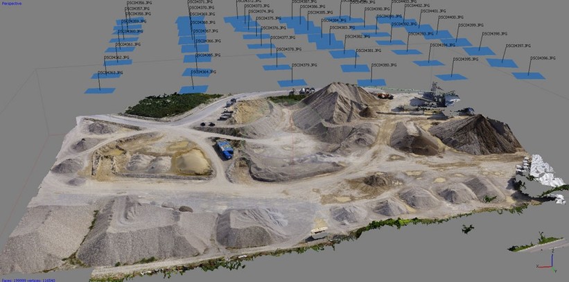
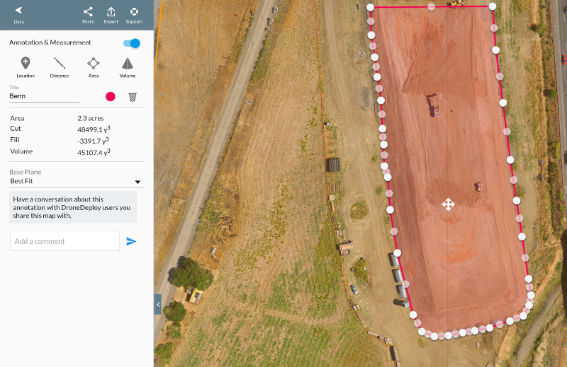
From preplanning a property for development to capturing the finished product, VAS can record, construct, and audit your whole project from the sky. Real world 3D virtual reality walk through of industrial plants, conducting environmental assessments, monitoring concurrent construction sites, and creating orthomosaics, point clouds, models and more.
Picture
Picture
©2022 Vandermissen Aeronautical Solutions, LLC. All rights reserved. Website design by Plus Promos.
  • Home
  • About
  • Services
    • Aerial Video & Photography
    • Motion Picture & News Filming
    • Real Estate Photography
    • Forestry & Agriculture Monitoring
    • Bridge & Tower Inspections
    • Disaster & Emergency Services
    • Mining Services
    • Project Monitoring
    • Geographic Information Systems Photography
    • Photogrammetry Designs & Topographic Mapping
  • Photos
  • Contact